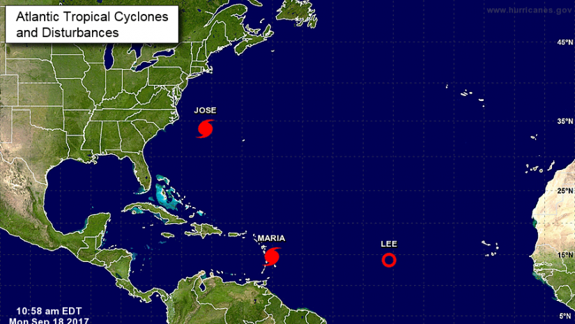
Hurricane Maria has rapidly intensified into a major hurricane and is now a Category 3 system. Additional rapid strengthening is forecast during the next 48 hours, and Maria is expected to be a dangerous major hurricane as it moves through the Leeward Islands and the northeastern Caribbean Sea.
A Hurricane Warning has been issued for the British Virgin Islands. A Hurricane Warning means that hurricane conditions are expected somewhere within the warning area. Preparations to protect life and property should be rushed to completion.
At 11:00 a.m., the center of Hurricane Maria was located near latitude 14.7 degrees North, longitude 60.1 degrees West or about 95 miles east-southeast of Dominica.
Maria is moving toward the west-northwest near 10 miles per hour (mph), and this motion with some decrease in forward speed is expected through Tuesday night.
On the forecast track, the center of Maria will move across the Leeward Islands late today and tonight and approach the Virgin Islands on Wednesday.
Reports from an Air Force Reserve Hurricane Hunter aircraft indicate that maximum sustained winds have increased to near 120 mph with gusts up to 140 mph.
The minimum central pressure estimated from the Hurricane Hunter aircraft data is 959 millibars.
Satellite imagery indicates the presence of a clearing eye, a sign that Maria is becoming an intense hurricane.
The other finding from the plane and from nearby surface observations is that Maria’s wind field is rather small compared to average. Hurricane-force winds extend out only to about 15 miles.
Without much land interaction, Maria may remain a small hurricane as it tracks through the northeast Caribbean over the next few days.
Maria is expected to produce total rain accumulations of 6 to 12 inches with isolated maximum amounts of 20 inches across the British Virgin Islands.
Rainfall on all of these islands could cause life-threatening flash floods and mudslides.
A dangerous storm surge accompanied by large and destructive waves will raise water levels by as much as 6 to 9 feet above normal tide levels in the hurricane warning area near where the center of Maria moves across the Leeward Islands and the British Virgin Islands.
The combination of a dangerous storm surge and the tide will cause normally dry areas near the coast to be flooded by rising waters, moving inland from the shoreline.
Hurricane force winds from Maria could blow debris from Hurricane Irma around, creating dangerous conditions. Residents are therefore encouraged to secure all loose items in and around their homes.
Residents are also urged to monitor the movement of Maria closely.
Please continue to monitor local media stations, DDM’s website (bviddm.com) and Facebook at BVIDDM for regular updates.
Disclaimer: The Department of Disaster Management (DDM) is not an official Meteorological Office. The Information disseminated by the Department is gathered from a number of professional sources used or contracted by the DDM to provide such information. This information is to be used as a guide by anyone who has interest in local weather conditions. By no means can the DDM or the BVI Government be held accountable by anyone who uses this information appropriately for legal evidence or in justification of any decision which may result in the loss of finances, property or life.