Synopsis: A cold front is expected to cause unsettled weather across the area over, at least, the next 24 hours. Meanwhile, the pressure gradient will again tighten and cause frequently fresh to strong and gusty winds. This will in turn produce hazardous seas. Possible rainfall total for the next 24 hours is 10 to 40 mm (0.40 to 1.60 in).
Weather tonight: Mostly cloudy with a 90 percent (or high) chance of showers, some likely heavy with a slight chance of thunderstorms.
Weather tomorrow: Mostly cloudy with a 80 percent (or high) chance of showers, some likely heavy with a slight chance of thunderstorms.
Winds: East-northeast at 20 to 31 km/h or 11 to 17 knots tonight and 24 to 41 km/h or 14 to 22 knots and gusting to around 59 km/h or 32 knots tomorrow.
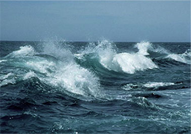
Seas: Rough with heights of 2.4 to 3.0 metres or 8 to 10 feet, occasionally reaching 4.0 metres or 13 feet. A small craft warning is in effect; small craft operators should not venture far from port.
Atmospheric Pressure: Above normal
Sunrise tomorrow: 6:33 am.
Sunset tomorrow: 6:26 pm.
Disclaimer: The Department of Disaster Management (DDM) is not an official Meteorological Office. The Information disseminated by the Department is gathered from a number of professional sources used or contracted by the DDM to provide such information. This information is to be used as a guide by anyone who has interest in local weather conditions. By no means can the DDM or the BVI Government be held accountable by anyone who uses this information appropriately for legal evidence or in justification of any decision which may result in the loss of finances, property or life.