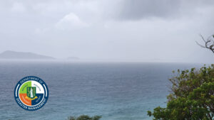
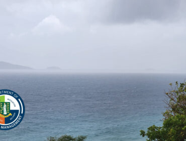
22ND January 2019 – A high swell event is forecast to impact the British Virgin Islands and other Caribbean islands later this week.
Dale Destin, Meteorologist/ Climatologist for Antigua & Barbuda Meteorological Services Climate Section, has indicated Swells are likely to exceed 2.5 metres (8 ft) and occasionally exceeding 3 metres (10 ft), coming out of the north. These swells will result in dangerous surfs for beachgoers; hence, advisories and or warnings will be required.
According to Mr. Destin, “The swell event will be generated by gale-force/storm-force winds, from a powerful low-pressure system, making its way across the northern North Atlantic. This is the same system that dumped an obscene amount of snow – over 660 mm (26 in) across parts the United States. Obviously, none of this weather will reach the Caribbean but the sea swells will”.
He continued, “The swells in and of themselves are not the real concern. The greater concern is the large breaking swells or high surfs that these swells will cause when they reach the shorelines across the region. Such long period swells can result in surfs as high as twice their heights i.e. up to 6 metres (20 ft)”.
These high surfs will have the potential impact of injuries or loss of life, beach closures and financial losses. Impacts could also include:
-disruption to potable water from desalination;
-salt water intrusion;
-flooding of low-lying coastal roads;
-beach erosion;
-disruptions to near shore marine recreation and businesses;
-damage to coral reefs and
-disruptions of marine transportation.
“The potential impacts listed above are just that – potential/possible impacts. I am not saying that they will all definitely happen, but conditions could result in such and past similar swell events have caused such”., Mr. Destin stated.
There is also concern for those who visit non-beach coastal areas. High surfs can knock spectators off exposed rocks and jetties. Those who rock fish need to pay attention and not expose themselves to this hazard. Breaking waves may occasionally impact harbours making navigating the harbour channel dangerous.
With this event happening near a full supermoon, high tides will be higher than usual; hence, coastal flooding and erosion are more likely than usual. Coastal flooding from the sea is largely depended on high tides, onshore wind and swell actions.
The British Virgin Islands should begin feeling the effects of this event by mid-week
If a high surf advisory is issued for an area – be extremely cautious; bathe only where lifeguards are present. If a high surf warning is issued – do not enter the water. Relatively safe conditions are likely on the opposite or southern sides of the islands.
If caught in a rip current, relax and float. Don`t swim against the current. If able, swim in a direction following the shoreline. If unable to escape, face the shore and call or wave for help.
Persons at home and abroad are encouraged to download the DDM’s Alert app in the Apple App store or Google Play store to receive updates of any hazards affecting the Territory.
You can also visit the DDM’s webpage at www.bviddm.com and subscribe for updates or like us on Facebook at www.facebook.com/bvi.ddm.
Disclaimer: The Department of Disaster Management (DDM) is not an official Meteorological Office. The Information disseminated by the Department is gathered from a number of professional sources used or contracted by the DDM to provide such information. This information is to be used as a guide by anyone who has interest in local weather conditions. By no means can the DDM or the BVI Government be held accountable by anyone who uses this information appropriately for legal evidence or in justification of any decision which may result in the loss of finances, property or life.