The Antigua & Barbuda Meteorological Services has issued a Tropical Storm Watch for the British Virgin Islands.
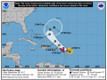
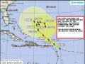
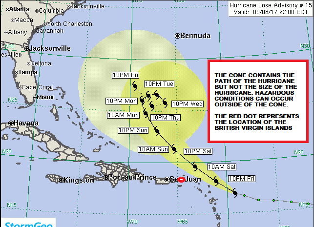
At 1100 PM, the eye of Hurricane Jose was located near latitude 16.9 North, longitude 59.3 West. Jose is moving toward the west-northwest near 16 mph. A slower west- northwestward motion is expected during the next couple of days. On the forecast track, Jose is expected to be near the northern Leeward Islands on Saturday.
Maximum sustained winds have increased to near 155 mph with higher gusts. Jose is a category 4 hurricane on the Saffir- Simpson Hurricane Wind Scale. Some fluctuation in intensity, up or down, could occur overnight and on Saturday. Gradual weakening is expected after that.
Hurricane-force winds extend outward up to 35 miles from the centre and tropical-storm-force winds extend outward up to 140 miles
The estimated minimum central pressure is 938 mb.
Persons in the British Virgin Islands should continue to pay close attention to the progress of Hurricane Jose as it gets closer to the Northern Leeward Islands
Please continue to monitor local media stations, DDM’s website (bviddm.com) and Facebook at BVIDDM for regular updates.
Disclaimer: The Department of Disaster Management (DDM) is not an official Meteorological Office. The Information disseminated by the Department is gathered from a number of professional sources used or contracted by the DDM to provide such information. This information is to be used as a guide by anyone who has interest in local weather conditions. By no means can the DDM or the BVI Government be held accountable by anyone who uses this information appropriately for legal evidence or in justification of any decision which may result in the loss of finances, property or life.