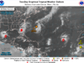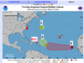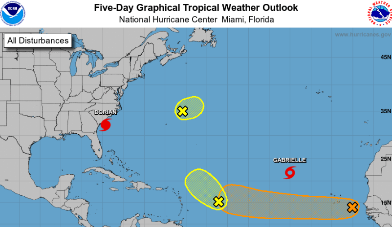
5 SEPTEMBER, 2019, 8am — Forecasters continue to monitor five different systems in the Atlantic this morning, including one that has a medium chance of developing further over the next five days.
HURRICANE DORIAN is currently located off the coast of South Carolina in the United States, with the potential to bring damaging winds, life-threatening storm surges, and flooding rains to both North and South Carolina coastlines today.
TROPICAL STORM GABRIELLE is poorly organised with winds of 50 miles per hour. The system is over the open Atlantic, about 1,210 miles south-southwest of the Azores. Gabrielle is moving toward the northwest near 8 mph, and this motion is expected to continue for the next few days with an increase in forward speed.
DISTURBANCE 1 is a small area of low pressure a few hundred miles northeast of Bermuda moving northeast farther out to sea. Forecasters give this one a 30 percent chance of further development over the next five days.
DISTURBANCE 2 is a trough of low pressure located about 500 miles east of the Leeward Islands. It’s producing a disorganised but large area of showers and thunderstorms. Forecasters expect that as this system moves slowly westward, it has a low chance of further development.
DISTURBANCE 3 is a broad area of low pressure associated with a tropical wave located about halfway between the west coast of Africa and the Cabo Verde Islands. Although the chance of development over the next 48 hours is low; the chances for further development increase to medium over the next five days as it continues west across the Atlantic.