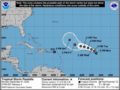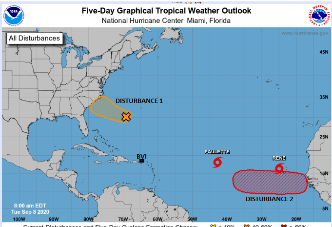
8TH September 2020 – The Atlantic is seeing a spike in activity as four systems are being monitored by the National Hurricane Centre. Two are showing increased signs of tropical cyclone formation in a few days while two tropical storms Paulette and Rene are east of the Caribbean. Present forecasts indicate that the tropical storms may move to the North and not threaten the Caribbean Islands which include the BVI. We will continue to monitor the storms though as conditions do change. Disturbance 2 is another vigorous disturbance expected to move off the African Coast at least by Wednesday or Thursday. This too is expected to gradually move to the North as it initially moves westward across the Atlantic however, this is based on are early forecast models and conditions can change as the disturbance progresses.
Residents are encouraged to be prepared and review plans and have them ready if needed. Please see the 5am update from the NHC.
At 500 AM, the center of Tropical Storm Paulette was located near latitude 18.1 North, longitude 42.8 West. Paulette is moving toward the northwest near 6 mph and should continue in this general motion with a faster forward speed later today, then move west-northwestward Wednesday through Friday.
Maximum sustained winds have increased to near 50 mph with higher gusts. Further strengthening is forecast during the next day or so, with little change in strength expected afterward through Thursday. Some weakening is expected Thursday evening and Friday.
Tropical-storm-force winds extend outward up to 105 miles from the center.
At 500 AM, the center of Tropical Storm Rene was located near latitude 16.4 North, longitude 24.9 West. Rene is moving toward the west near 15 mph, and a motion toward the west to west-northwest is expected over the next few days. On the forecast track, the center of Rene will pass over the central and western Cabo Verde Islands today, and then move away from the islands tonight.
Maximum sustained winds are near 40 mph (65 km/h) with higher gusts. Little change in strength is expected today, followed by gradual strengthening tonight into Thursday, with Rene forecast to become a hurricane in a couple of days.
Tropical-storm-force winds extend outward up to 45 miles from the center.
Disturbance 2 has been identified over Burkina Faso and southern Mali near 11N, 5W. The disturbance is moving to the west at 15 to 20 mph. Disturbance 2 will likely emerge off of the coast of Africa near Guinea by Wednesday night into Thursday. This system may develop into a tropical storm on Thursday into Friday as it passes near the southern Cabo Verde Islands. Afterward, it will track to the west-northwest across the tropical Atlantic. It may track just to the north of the northeastern Caribbean in about 8 to 10 days from now. There is a 70 percent chance that the system will develop over the next 5 days.
Persons at home and abroad are encouraged to download the DDM’s Alert app in the Apple App store or Google Play store to receive updates of any hazards affecting the Territory.
You can also visit the DDM’s webpage at www.bviddm.com and subscribe for updates or like us on Facebook at www.facebook.com/bvi.ddm.
Disclaimer: The Department of Disaster Management (DDM) is not an official Meteorological Office. The Information disseminated by the Department is gathered from a number of professional sources used or contracted by the DDM to provide such information. This information is to be used as a guide by anyone who has interest in local weather conditions. By no means can the DDM or the BVI Government be held accountable by anyone who uses this information appropriately for legal evidence or in justification of any decision which may result in the loss of finances, property or life.