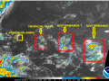
Forecasters at the Antigua & Barbuda Meteorological Services continue to monitor a number of tropical waves in the Atlantic.
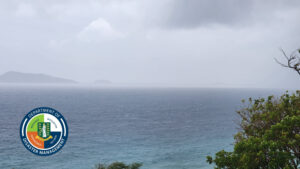
In their latest forecast, A Flash Flood Watch was issued for the British Virgin Islands until 12 midnight. A flash flood watch means that moderate to major flooding is possible but not imminent in the watch area. As the tropical wave moves through the area, there is a possibility for more showers and thunderstorms through tomorrow morning. Residents in low lying and flood prone areas should make preparations for flooding to safe guard life and property. They should be prepared to move to higher ground if flooding rains develop or a flash flood warning is issued.
Other Disturbances
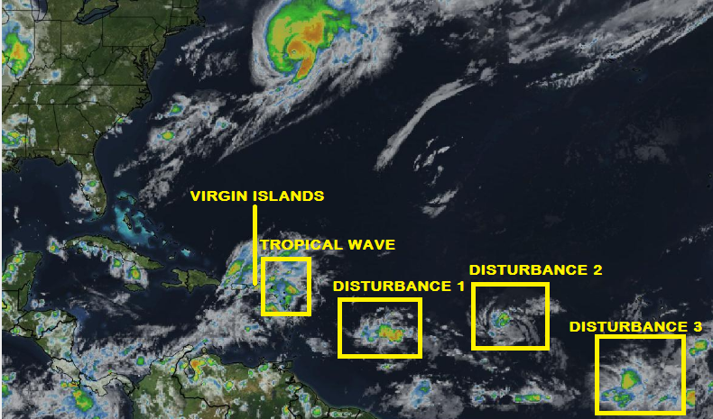
There are three other disturbances in the Atlantic being monitored by the National Hurricane Centre.
Disturbance 1 – Showers and thunderstorms associated with a low pressure system located about 650 miles east of the Lesser Antilles have become a little more concentrated this afternoon. Upper-level winds are forecast to become more conducive for development during the next day or so while the low moves westward at 15 to 20 mph across the tropical Atlantic Ocean, crossing into the Caribbean Sea on Friday. Regardless of development, locally heavy rainfall and gusty winds are expected to spread across portions of the Lesser Antilles on Thursday night and Friday, and interests there and elsewhere in the eastern Caribbean should monitor the progress of this disturbance. An Air Force Reserve reconnaissance aircraft is scheduled to investigate this system on Thursday.
Disturbance 2 – A second area of low pressure is located about 950 miles west of the Cabo Verde Islands, and its associated shower and thunderstorm activity remains disorganized. Gradual development of this system is possible during the next few days while it moves west-northwestward at 15 to 20 mph, but upper-level winds are expected to become less conducive for tropical cyclone formation when the disturbance moves north of the Leeward Islands this weekend.
Disturbance 3 – A tropical wave located southeast of the Cabo Verde Islands is producing disorganized showers and thunderstorms. Environmental conditions are forecast to become more conducive for development over the weekend while the system moves westward to west-north westward at about 15 mph.
Residents are advised to monitor these systems closely as they have the potential to affect the territory.
The DDM will continue to monitor these weather systems and provide updates when they become available.
Please continue to monitor local media stations, DDM’s website (bviddm.com) and Facebook at BVIDDM for regular updates.
Image credited to Mapbox
Disclaimer: The Department of Disaster Management (DDM) is not an official Meteorological Office. The Information disseminated by the Department is gathered from a number of professional sources used or contracted by the DDM to provide such information. This information is to be used as a guide by anyone who has interest in local weather conditions. By no means can the DDM or the BVI Government be held accountable by anyone who uses this information appropriately for legal evidence or in justification of any decision which may result in the loss of finances, property or life.