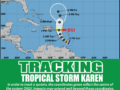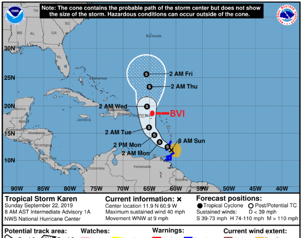
22nd September 2019 – At 800 AM, the centre of Tropical Storm Karen was located near latitude 11.9 North, longitude 60.9 West. Karen is moving toward the west-northwest near 9 mph and this general motion is expected to continue today. A turn toward the northwest is forecast to occur on Monday, followed by a turn toward the north on Tuesday. On the forecast track, Karen will move across the Windward Islands today, and emerge over the southeastern Caribbean Sea tonight. On Tuesday, Karen is expected to approach the British Virgin Islands.
Maximum sustained winds are near 40 mph with higher gusts. Little change in strength is forecast during the next 48 hours.
Tropical-storm-force winds extend outward up to 125 miles from the centre.
Impacts on the British Virgin Islands
- Winds gusting to tropical force are possible.
- Possible rainfall amounts of 1 to 3 inches with higher amounts. Figures are based on current information.
Persons can also download the Alert app in the Apple App store or Google Play store to receive updates of any hazards affecting the Territory.
You can also visit the DDM’s webpage at www.bviddm.com and subscribe for updates or like us on Facebook at www.facebook.com/bvi.ddm.
Disclaimer: The Department of Disaster Management (DDM) is not an official Meteorological Office. The Information disseminated by the Department is gathered from a number of professional sources used or contracted by the DDM to provide such information. This information is to be used as a guide by anyone who has interest in local weather conditions. By no means can the DDM or the BVI Government be held accountable by anyone who uses this information appropriately for legal evidence or in justification of any decision which may result in the loss of finances, property or life.