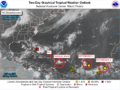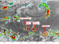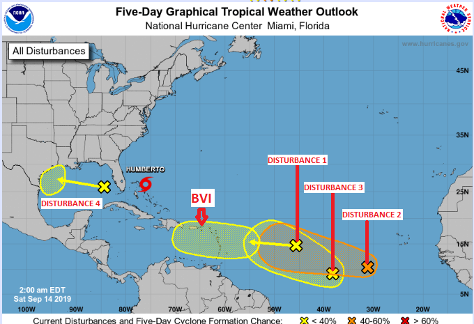
14TH September 2019 – Disturbance 2 is located along 32W and is moving towards the west at around 10 mph. The system will likely continue to track westward over the next several days. The disturbance has become better organized over the past 24 hours, and model support has increased. Conditions are forecast to become more favorable for development over the next few days, and a tropical storm could form early next week. The chance of tropical development over the next week is 60 percent. This system is approximately a week away (this is subject to change if speed increases) from the British Virgin Islands. We will monitor closely and continue to provide information on its progress.
Disturbance 1 is located along 45W and is now moving towards the west at around 25 mph. This fast moving system has weakened over the past 24 hours, and model support has decreased as well. A continued westward motion is expected over the next several days. The chance of tropical development over the next week is 20 percent. Present forecast information has the system passing near to the British Virgin Islands early next week producing gusty winds and possible heavy rainfall.
Disturbance 3 has formed between disturbance 1 and 2. National Hurricane Centre has indicated there is a possibility for this system merge with disturbance 2 if not more strengthening is possible if remains a singular system. For this forecast period it has been given a 20 percent change of development.
Other areas of interest
Tropical Storm Humberto is currently located about 200 miles east-southeast of Freeport, Bahamas. Winds are estimated to be around 40 mph. This system will likely track towards the north and northwest over the next few days, followed by a turn towards the east and northeast next week.
Disturbance 4 has been identified in the central Gulf of Mexico. The system is currently a mid to upper-level low pressure area. Conditions could become favorable for some tropical development over the next few days before it moves inland into Texas early next week. If development occurs, the system likely wouldn’t become stronger than a weak tropical storm. This system will have no impact on the British Virgin Islands
Residents and visitors are urged to continue monitoring the three systems as they are presently East of the British Virgin Islands and can pose a threat to our location in the coming days.
Persons at home and abroad are encouraged to download the DDM’s Alert app in the Apple App store or Google Play store to receive updates of any hazards affecting the Territory.
You can also visit the DDM’s webpage at www.bviddm.com and subscribe for updates or like us on Facebook at www.facebook.com/bvi.ddm.
Disclaimer: The Department of Disaster Management (DDM) is not an official Meteorological Office. The Information disseminated by the Department is gathered from a number of professional sources used or contracted by the DDM to provide such information. This information is to be used as a guide by anyone who has interest in local weather conditions. By no means can the DDM or the BVI Government be held accountable by anyone who uses this information appropriately for legal evidence or in justification of any decision which may result in the loss of finances, property or life.