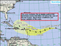
Hurricane Irma Summary:
Current Location: 18.5 degrees North, 37.8 degrees West
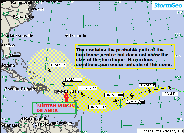
Geographic Reference: 1840 miles east of the British Virgin Islands
Movement: West at 13 mph
Max Winds: 110 mph with higher gusts
Hurricane Force Winds: 15 miles
Current Radius of Tropical Storm-Force Winds: 90 miles
Minimum Central Pressure: 972 Millibars
Key Points
- Irma is expected to strengthen into a category 4 hurricane by next Wednesday.
- Irma may pass very close to the northeast Caribbean islands as a major hurricane next Wednesday.
Irma may experience a fluctuation in strength for the next few days. Regardless, Irma will be moving over progressively warmer water over the coming days, which may result in gradual strengthening to a Category 4 hurricane with maximum sustained winds up to 140 mph by the time it passes northeast of the Caribbean next Wednesday.
By the time Irma passes north of the islands of the northeast Caribbean, hurricane-force winds are expected to extend only to about 25 miles south of Irma’s center. On its current track, Irma’s hurricane-force winds would stay north of the islands. However, any slight deviation south of the forecasted track could put very strong hurricane-force winds into the Caribbean islands.
Expected Impacts on Land:
Northeast Caribbean Islands: Current forecast tracks indicated that squalls will reach the area next Tuesday night with possible tropical storm-force or greater winds next Wednesday.
The British Virgin Islands (BVI) is located in the northeast Caribbean and as such the Department of Disaster Management (DDM) is encouraging all persons to use the time now to intensify preparations for any potential impact.
Irma has the potential to cause significant rainfall, strong winds and storm surge across the Territory, if it moves into the British Virgin Islands. Residents and businesses in low-lying, coastal and flood prone communities will need to take steps to minimise or prevent flooding, check roofs, clear roof gutters and drains around your property and inspect your cistern outflows. Individuals are encourage to utilize flood protection items such as flood boards and sand bags to prevent or slow the flow of water into their homes and businesses.
The DDM will continue to monitor this system and will provide updates and preparedness information. Please ensure that you are able to access these updates and we urge you to act on the information that is being provided.
Information can be obtained from local media stations, DDM’s website (bviddm.com) and Facebook at BVIDDM.
Disclaimer: The Department of Disaster Management (DDM) is not an official Meteorological Office. The Information disseminated by the Department is gathered from a number of professional sources used or contracted by the DDM to provide such information. This information is to be used as a guide by anyone who has interest in local weather conditions. By no means can the DDM or the BVI Government be held accountable by anyone who uses this information appropriately for legal evidence or in justification of any decision which may result in the loss of finances, property or life.