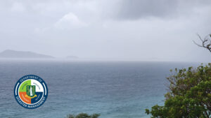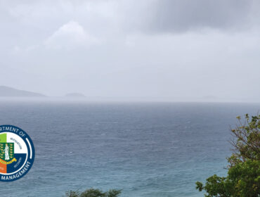
7th February – Synopsis: A surface high pressure in the Atlantic will continue to promote breezy conditions across the region for the next couple of days. Patches of low level moisture embedded in the trade wind flow will continue to move across the area producing brief periods of passing showers across the islands. The combination of high winds and northerly swells will support hazardous sea conditions across the area.
Wx: today: partly cloudy. Few passing showers could also develop. Tonight: partly cloudy with a slight chance of few passing showers.
Winds: ENE – E 12-18kts or 22-33 km/h and reaching to 22-24kts or 41 to 44 km/h over coastal waters with higher gusts in showers…
Seas: rough with swells 2.4 to 3.4 m or 8 to 11 ft. Warning is in place for small craft operators and sea bathers…
Sunset today: 6:16 pm.
Sunrise tomorrow: 6:49 am.
Please continue to monitor local media stations, DDM’s website at bviddm.com) and Facebook at BVIDDM for regular updates.
Disclaimer: The Department of Disaster Management (DDM) is not an official Meteorological Office. The Information disseminated by the Department is gathered from a number of professional sources used or contracted by the DDM to provide such information. This information is to be used as a guide by anyone who has interest in local weather conditions. By no means can the DDM or the BVI Government be held accountable by anyone who uses this information appropriately for legal evidence or in justification of any decision which may result in the loss of finances, property or life.