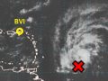
Synopsis: As Tropical depression Karl or its remnants move north of the islands today, it will induce a light wind flow over the Leeward Islands and BVI. This, along with available moisture and daytime heating will create an environment that is favorable for the formation of convective activity over and around these islands. Motorist are particularly advised to be cautious while navigating if heavier downpours develop
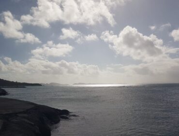
Today: Partly cloudy in the morning with a high chance of skies becoming locally cloudy in the afternoon with scattered showers. Some showers could be locally heavy and thundery at times
Tonight: Decreasing clouds and shower activity
Winds: NE – N at 4-8kts shifting to S – SW this afternoon and becoming variable of calm at times but mainly tonight.
Seas: Moderate to rough with swells 1.5-2.1m or 5-7ft in the Atlantic Ocean east and north of the Leeward Islands and BVI and a small craft advisory is in effect.
Atmospheric Pressure: A little below normal
Sunset today: 6:15 pm.
Sunrise tomorrow: 6:07 am.
Please visit the DDM at www.bviddm.com and subscribe for updates or join us on facebook at https://www.facebook.com/bvi.ddm/