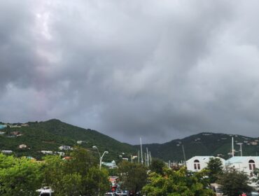
Synopsis: shallow low level patches embedded within a moderate to brisk trade wind flow will continue to move across the area and maintain a moderate chance for shower activity over and around the islands tonight into the first part of tomorrow. By late tomorrow evening into the night, the tail end of a frontal trough will sweep across the area and further heighten the chances for shower activity during that time.
Weather tonight: Fair to partly cloudy and breezy conditions with a 40 percent or slight chance of a brief passing shower.
Weather tomorrow: Partly cloudy to cloudy and breezy conditions, with a 70 percent or high chance of showers.
Winds: East-northeast at 26 to 37 km/h or 16 to 23 mph, reaching as high as 52 km/h or 32 mph during showers, as well as over open waters and in elevated areas..
Seas: 2.1 to 3.4 metres(7 to 11 feet), occasionally or locally reaching 4.5 metres (15 feet). Swell period: 10 to 14 seconds.
Sunrise tomorrow: 6:53 am.
For more weather information, you can visit the Department of Disaster Management WeatherStem Station on the link provided. http://bvi.weatherstem.com/tortola
Disclaimer: The Department of Disaster Management (DDM) is not a Meteorological Office. Information shared by the Department is gathered from a number of professional sources contracted by the Department. This information should be used as a guide for anyone who has an interest in local weather conditions. By no means can DDM or the Government of the Virgin Islands be held accountable by anyone who uses this information appropriately for legal evidence or in justification of any decision, which may result in the loss of finances, property or life