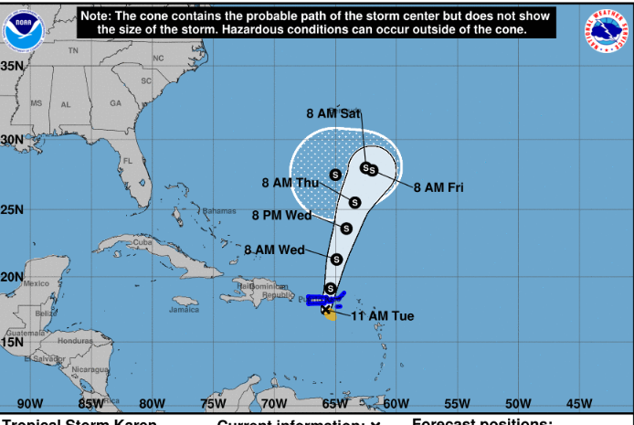
24th September 2019 – At 2PM Tropical Storm Karen has gotten stronger with winds of 45 mph. The system maintains tropical storm force winds up to 80 miles from the centre with a forward speed of 8 mph.
The centre has reformed a little more to the west with the eye of Karen now being approximately 111 miles WSW from Road Town. Karen is expected to bring tropical storm force wind conditions and heavy rainfall in the range of 3 – 6 inches with isolated higher amounts as much as 8 inches.
A flash flood watch remains in effect for the British Virgin Islands and may be increased to a Flash Flood Warning later today. Karen’s closest approach is expected to be 65 miles to the west. Since the southern part of system has most of the convection, and as the system pulls further north to north north east, we may see an increase in gusty winds and heavy rainfall later this afternoon into tonight. These conditions have the potential to create wide spread flooding.
Full update to follow at 5PM.