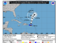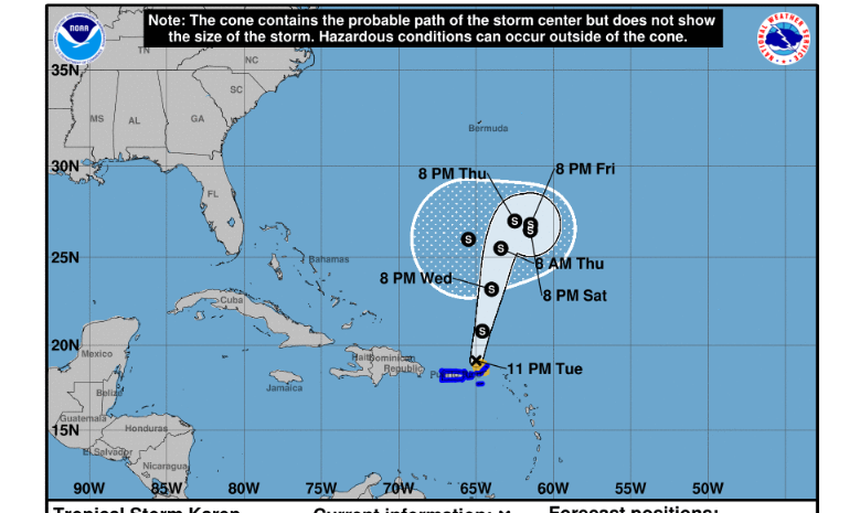
At 11PM Tropical Storm Karen was located at 19.1 degrees north, 65.0 degrees west or approximately 54 miles north northwest of the Road Town. A tropical storm warning remains in effect for the British Virgin Islands. Maximum sustained winds remain at 45 mph with higher gusts. Karen’s forward speed is now 14 mph. Tropical Storm force winds extend 80 miles from the centre keeping the BVI still within the area of convection, although there has been a reduction in shower activity.
Forecasters have indicated that the reformation of the eye earlier today provided the necessary conditions needed to shift some of the showers to the west of the BVI. As there is still an abundance of moisture lingering in the atmosphere, forecasters anticipate the possibility of a further 1–2 inches of rainfall going into the morning hours of Wednesday, 25 September 2019. As a result, the Flash Flood Warning will remain in place until 6am, Wednesday, and further evaluated after that time.
Seas are within 6–10 feet thus all warnings issued for hazardous sea conditions remain in place. Some coastal roads have been affected by Karen and may not be safe for passage at this time. Residents are encouraged to continue monitoring the updates as the storm slowly exits our area.