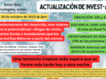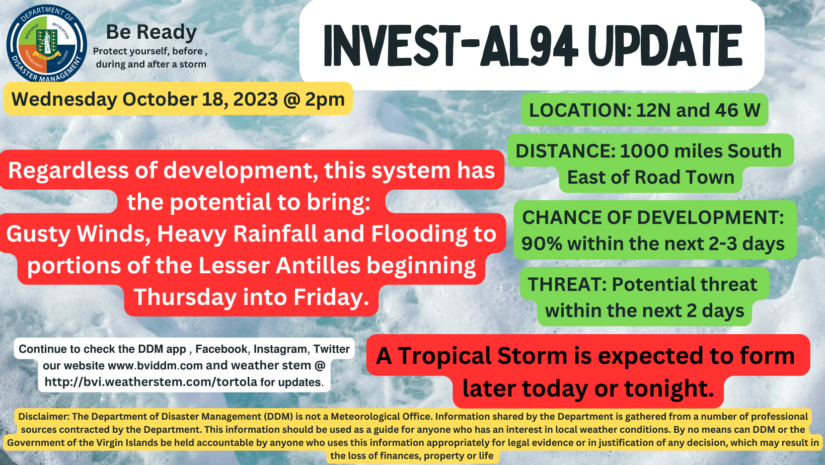
As invest 94L inches closes to the Caribbean the threat to islands gets higher. This disturbance is just over a 1000 miles SE of Road Town. Heavy rainfall and flash flooding could potentially affect the Leeward Islands starting Friday and to a lesser extent the BVI going to Saturday.
There is still a bit of uncertainty and with that, we cannot be too comfortable as this disturbance will be a developing system a possible tropical storm as it tracks in our area.
With that being said areas that are vulnerable to flooding should ensure that the preparations are in place should there be any shift in the system. Islands that are to the north like Anegada may get a little more rainfall than other islands based on the current movement.
For more weather information, you can visit
https://www.nhc.noaa.gov/gtwo.php?basin=atlc&fdays=7
Disclaimer: The Department of Disaster Management (DDM) is not a Meteorological Office. Information shared by the Department is gathered from a number of professional sources contracted by the Department. This information should be used as a guide for anyone who has an interest in local weather conditions. By no means can DDM or the Government of the Virgin Islands be held accountable by anyone who uses this information appropriately for legal evidence or in justification of any decision, which may result in the loss of finances, property or life