Home Latest News EVENING FORECAST FOR THE VIRGIN ISLANDS

EVENING FORECAST FOR THE VIRGIN ISLANDS

by Andrew Jackson
0 comments

Synopsis: A shortwave trough along with moisture brought into the area on a moderate to fresh wind flow will continue to maintain a moderate chance of showers over the Leeward Islands. Meanwhile, over the British Virgin Islands, a wide band of moisture is maintaining a heightened chance of shower activity over these islands.

Weather tonight: Cloudy skies with a 80 percent or high chance of showers and a 20 percent or slight chance of thunderstorms

Weather tomorrow: Cloudy skies with a 80 percent or high chance of showers and a 20 percent or slight chance of thunderstorms

Winds: East to East-northeast at 22 to 37 km/h or 14 to 23 mph with higher gusts..

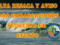
Seas: 1.8 to 2.8 meters or 6 to 9 feet with northeasterly swells of up to 2.1 meters or 7 feet. Therefore a High Surf Advisory remains in effect..

Sunrise tomorrow:  6:42 am.

Sunset tomorrow:  5:45 pm.

For more weather information, you can visit the Department of Disaster Management WeatherStem Station on the link provided. http://bvi.weatherstem.com/tortola
Disclaimer: The Department of Disaster Management (DDM) is not a Meteorological Office. Information shared by the Department is gathered from a number of professional sources contracted by the Department. This information should be used as a guide for anyone who has an interest in local weather conditions. By no means can DDM or the Government of the Virgin Islands be held accountable by anyone who uses this information appropriately for legal evidence or in justification of any decision, which may result in the loss of finances, property or life

You may also like

About Us

The Department of Disaster Management is a government department which operates under the legal authority of the Deputy Governor’s Office.

Contact

Feature Posts

Newsletter

©2025 DEPARTMENT OF DISASTER MANAGEMENT, BRITISH VIRGIN ISLANDS.