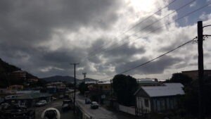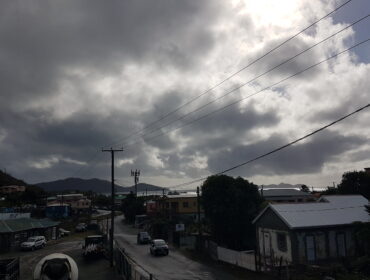
Synopsis: A surface trough northeast of the Leeward Islands is triggering some unsettled conditions for the area. However, beginning tomorrow, a relatively strong high pressure system moving in from the west will result in the winds becoming moderate to fresh and could also trigger occasional showers across the area.
Weather tonight: Partly cloudy with a 60 percent or a moderate chance of showers.
Weather tomorrow: Partly sunny with a 40 percent or a moderate chance of showers.
Winds: Northeast with speeds ranging from 26 to 39 km/h or 16 to 24 mph gusting at times to 61 km/h/ 38 mph.
Seas: 1.2 to 2.4 metres or 4 to 8 feet.
Sunrise tomorrow: 6:37 am.
For more weather information, you can visit the Department of Disaster Management WeatherStem Station on the link provided. http://bvi.weatherstem.com/tortola
Disclaimer: The Department of Disaster Management (DDM) is not a Meteorological Office. Information shared by the Department is gathered from a number of professional sources contracted by the Department. This information should be used as a guide for anyone who has an interest in local weather conditions. By no means can DDM or the Government of the Virgin Islands be held accountable by anyone who uses this information appropriately for legal evidence or in justification of any decision, which may result in the loss of finances, property or life