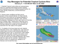
29th July 2020 – The National Hurricane Centre continues to monitor Potential Tropical Cyclone Nine (PTC-9). This system may be upgraded to a Tropical Storm today.
Potential Tropical Cyclone means a disturbance that is not yet a tropical cyclone but which poses the threat of bringing tropical storm or hurricane conditions to land areas within 48 hours.
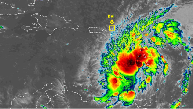
At 5 am Potential Tropical Cyclone Nine was located 15.3 degree north, 61.3 degrees west or approximately 290 miles east south east of the British Virgin Islands.
Movement is to the west northwest at 23 mph, winds are 45 mph with higher gusts.
Tropical storm force type winds extend from the centre outward up to 275 miles.
Minimum Central Pressure is 1005 Mb
Potential impacts
• Rainfall between 3 – 6 inches with maximum amounts of 10 inches in some locations.
• Winds may increase to 50 – 60 mph. Power outages are possible.
• Storm surge is possible for shoreline areas
• A Small Craft Warning has been issued until Thursday.
Persons at home and abroad are encouraged to download the DDM’s Alert app in the Apple App store or Google Play store to receive updates of any hazards affecting the Territory.
You can also visit the DDM’s webpage at www.bviddm.com and subscribe for updates or like us on Facebook at www.facebook.com/bvi.ddm.
Disclaimer: The Department of Disaster Management (DDM) is not an official Meteorological Office. The Information disseminated by the Department is gathered from a number of professional sources used or contracted by the DDM to provide such information. This information is to be used as a guide by anyone who has interest in local weather conditions. By no means can the DDM or the BVI Government be held accountable by anyone who uses this information appropriately for legal evidence or in justification of any decision which may result in the loss of finances, property or life.