105
TIMING
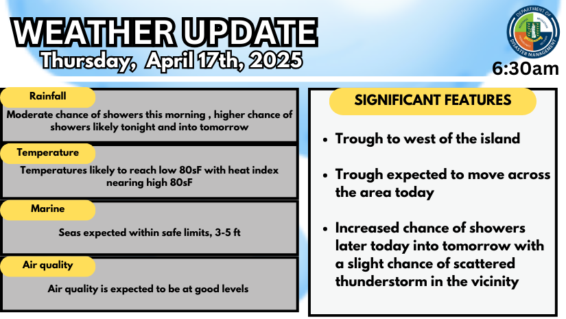
- This evening into tonight: There is an increasing chance of showers, especially later in the evening and overnight.
- Late night to predawn hours: We may see a few scattered thunderstorms in the vicinity of the Territory
- Friday: Expect on and off showers for at least the first half of the day.
POTENTIAL IMPACTS:
With the incoming rain it could cause:
• Rapid runoff on hillsides, increasing risk of minor landslides or loose rocks on roads.
• Localized ponding (minor flooding) in valleys, and poorly drained urban areas.
• Reduced visibility during heavy showers and slippery roads.
TIPS TO KEEP IN MIND:
- Avoid flood-prone areas – Don’t attempt to walk or drive through flooded roads.
- Clear drains and gutters – Especially important in low-lying areas to prevent water buildup.
- Be alert when traveling through hilly areas – Watch for fallen rocks or mud on the road.
Stay dry! Keep safe!
For more weather information, visit the Department of Disaster Management WeatherStem Station on the provided link: http://bvi.weatherstem.com/tortola
Disclaimer: The Department of Disaster Management (DDM) is not a Meteorological Office. Information the Department shares is gathered from several professional sources contracted by the Department. This information should be used as a guide for anyone interested in local weather conditions. By no means can DDM or the Government of the Virgin Islands be held accountable by anyone who uses this information appropriately for legal evidence or in justification of any decision, which may result in the loss of finances, property, or life.


