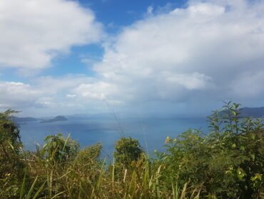
Locations to be affected: Reefs and mainly exposed eastern coastlines with relatively shallow, gentle to moderately sloping, nearshore areas.
Timing: Until Saturday night for Antigua, Barbuda, Montserrat, St. Kitts, Nevis and Anguilla, and until Saturday night for the British Virgin Islands.
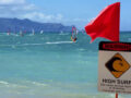
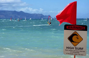
Synopsis: Moderate long-period swells are expected to reach the area and mainly affect eastern coastlines. The threat level to the life, livelihood, property and infrastructure of those using the affected coastlines is to rise to high, with the potential for extensive impacts. These swells are expected to cause life-threatening surfs and rip currents for affected coastlines. A high surf warning means that dangerous battering surfs of over 3 meters or over 10 feet will affect some coastlines in the warning area, producing very hazardous conditions.
Seas (significant wave heights): 3.0 to 5.5 meters (10 to 18 feet), occasionally or locally reaching near 7.0 meters (23 feet).
Swell period: 10 to 16 seconds. Swells: East at 2.1 to 3.0 meters (7 to 10 feet) and occasionally higher.
Surfs (breaking swells): Over 3 meters (over 10 feet). These conditions will be very conducive for dangerous rip currents. Please note that surfs could be as much as twice the height of swells, depending on the bathymetry of the nearshore areas.
Coastal flooding: High tides combined with onshore wind and swell actions will result in coastal flooding and beach erosion.
Potential Impacts: Loss of life–strong currents that can carry even the strongest swimmers out to sea; injuries to beachgoers; beach erosion; sea water splashing onto low-lying coastal roads; beach closures; disruptions to marine recreation and businesses; financial losses; damage to coral reefs; salt-water intrusion and disruptions to potable water from desalination. High surfs can knock spectators off exposed rocks and jetties. Breaking waves may occasionally affect harbors making navigating the harbor channel dangerous.
Precautionary actions: No one should enter the waters of the main warning areas. All are also urged to stay away from rocky and or coastal structures along affected coastlines.
Rip currents are powerful channels of water flowing quickly away from shore, which occur most often at low spots or breaks in the sandbar and near structures such as groins, jetties and piers. If caught in a rip current, relax and float. Do not swim against the current. If able, swim in a direction following the shoreline. If unable to escape, face the shore and call or wave for help.
Please continue to monitor these hazardous, life-threatening marine conditions.
Forecaster: Dale Destin
For more weather information, you can visit the Department of Disaster Management WeatherStem Station on the link provided. http://bvi.weatherstem.com/tortola
Disclaimer: The Department of Disaster Management (DDM) is not a Meteorological Office. Information shared by the Department is gathered from a number of professional sources contracted by the Department. This information should be used as a guide for anyone who has an interest in local weather conditions. By no means can DDM or the Government of the Virgin Islands be held accountable by anyone who uses this information appropriately for legal evidence or in justification of any decision, which may result in the loss of finances, property or life