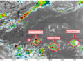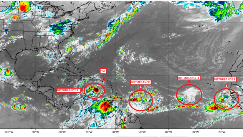
31ST August 2020 – Multiple disturbances are being monitored in the Atlantic. Disturbance 1 passed south of the territory last evening. Some trailing bands are creating minimal shower activity. A disturbance not on the NHC forecast page is moving to the west northwest towards the Leeward Islands and two disturbances continue to move west. No indication of any threat has been announced at this point however, residents should continue to monitor and have plans prepared for any changes.
Disturbance 1 is located about 175 miles north of Aruba near 15N, 70W. The system is becoming better organized as it tracks west-northwestward across the Caribbean Sea. This general motion is expected to persist, and this will take the disturbance towards Central America by Thursday. The system will likely become a tropical depression or tropical storm before landfall occurs. Regardless of development, heavy rains are likely later this week for Honduras, Belize, northern Guatemala, and southern Mexico. The chance of tropical development is near 80 percent. This will be our final on disturbance 1.
A Disturbance is located about 650 miles east of Barbados near 12N, 50W. This disturbance is not highlighted on the NHC forecast page. The disturbance has slowed since the previous forecast and is expected to track west-northwestward over the next several days taking the system towards the Leeward Islands by this weekend. Environmental conditions are only expected to be marginally conducive for further development. The chance of tropical development is near 20 percent.
Disturbance 4 is located about 700 miles west of the Cabo Verde Islands near 15N, 35W. The disturbance has become less organized. A general motion towards the west is expected over the next few days. Conditions are only forecast to be marginally conducive for development. The chance of tropical development is near 20 percent.
Disturbance 3 is located just off the west coast of Africa along 20W. A slow westward motion is expected to begin later this week. Conditions could become more favorable for development by the end of the week. The chance of tropical development is near 20 percent.
Persons at home and abroad are encouraged to download the DDM’s Alert app in the Apple App store or Google Play store to receive updates of any hazards affecting the Territory.
You can also visit the DDM’s webpage at www.bviddm.com and subscribe for updates or like us on Facebook at www.facebook.com/bvi.ddm.
Disclaimer: The Department of Disaster Management (DDM) is not an official Meteorological Office. The Information disseminated by the Department is gathered from a number of professional sources used or contracted by the DDM to provide such information. This information is to be used as a guide by anyone who has interest in local weather conditions. By no means can the DDM or the BVI Government be held accountable by anyone who uses this information appropriately for legal evidence or in justification of any decision which may result in the loss of finances, property or life.