Map
category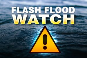
FLASH FLOOD WATCH IN EFFECT FOR THE VIRGIN ISLANDS
FLASH FLOOD WATCH ANTIGUA AND BARBUDA METEOROLOGICAL SERVICES 6:36 PM ECT TUE, FEB 6, 2024 FOR THE BRITISH VIRGIN ISLANDS...
WEATHER SYSTEM TRACKING MAP AVAILABLE FOR DOWNLOAD AND HOME PRINTING
Residents can follow the progress of tropical weather systems at home using the latitude and longitude coordinates and this printable...
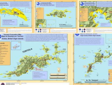
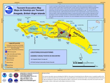
TSUNAMI EVACUATION MAPS
Do you know where to go in case of a tsunami evacuation? These maps can help you plan where to...
PLAN YOUR EVACUATION ROUTE IN CASE OF A TSUNAMI
These maps are always available on our website to help you plan the safest place to be in the event...
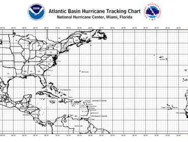
ATLANTIC BASIN HURRICANE TRACKING CHART
Click on the preview image below for a link to a printable chart to help you plot latitude and longitude...