Home Latest News PLAN YOUR EVACUATION ROUTE IN CASE OF A TSUNAMI

PLAN YOUR EVACUATION ROUTE IN CASE OF A TSUNAMI

by Chrystall Kanyuck-Abel
0 comments

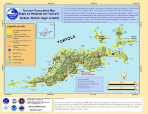
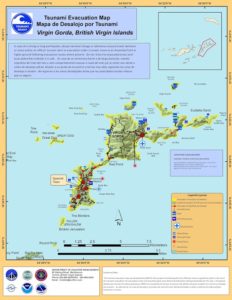
These maps are always available on our website to help you plan the safest place to be in the event of a tsunami warning. Areas shown in yellow are in the inundation zone. Areas shown in green are in the safe zone.

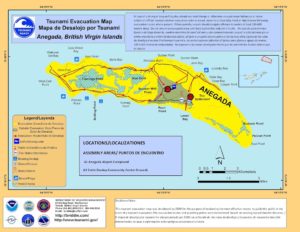
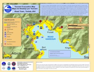
You can print or download the full size maps from the links below:
Anegada
Jost Van Dyke
Road Town
Tortola
Virgin Gorda

You may also like

About Us

The Department of Disaster Management is a government department which operates under the legal authority of the Deputy Governor’s Office.

Contact

Feature Posts

Newsletter

©2025 DEPARTMENT OF DISASTER MANAGEMENT, BRITISH VIRGIN ISLANDS.