
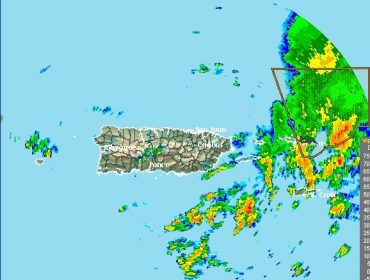
UPDATE- MORE SHOWERS AND THUNDERSTORMS MOVING IN FROM THE SOUTH EAST
Dopplar Radar out of San Juan, Puerto Rico, has indicated more showers and thunderstorms are possible for the next few...

FLASH FLOOD WARNING ISSUED UNTIL 10PM
A FLASH FLOOD WARNING IS IN EFFECT FOR LOW LYING AND FLOOD PRONE AREAS OF THE BRITISH VIRGIN ISLANDS VALID...
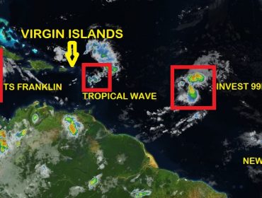
TROPICAL STORM FRANKLIN FORMS..INVEST 99L POORLY ORGANIZED..WEAK TROPICAL WAVE TO AFFECT THE VI TODAY..NEW TROPICAL WAVE EMERGES
TROPICAL WAVE A weak tropical wave will generate unstable weather conditions across the Islands today and tonight. Conditions today could...

HEAVY EQUIPMENT OPERATORS’ WORKSHOP
SAVE THE DATE Heavy Equipment Operators' Workshop 6 September 2017 Register before 29 August 2017 by calling 468-4200 or online at https://www.surveymonkey.com/r/Heavy_Equip
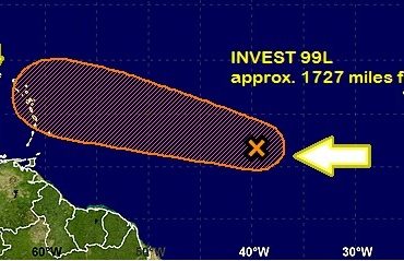
INVEST 99L SLOWS SLIGHTLY..POSSIBLE GUSTY WINDS AND HEAVY RAIN TO IMPACT THE LEEWARD ISLANDS
Image courtesy of the National Hurricane Centre Invest 99L (Disturbance 2) is located approximately 13N, 39W (1727 miles from the...
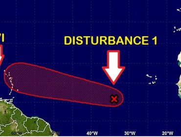
DISTURBANCE 1 MOVING WNW..POSSIBLE IMPACT NEXT WEEK
Image credited to the National Hurricane Centre Disturbance 1(Invest 99L) was last noted near 9.9N 33.0W (approximately 2178 miles) and...
SMALL CRAFT WARNING ISSUED FOR SMALL CRAFT AND SEA BATHERS
Synopsis: A drier and more stable low level atmosphere associated with a high pressure ridge will continue to sit across the...
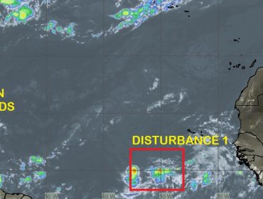
DISTURBANCE 1 SHOWING SIGNS OF DEVELOPMENT
Disturbance 1 is near 9.5N, 28.5W (approximately 2478 miles from the VI) and is moving to the west near 20...
WEATHER FORECAST FOR THE VI
Synopsis: Lingering moisture and instability from the passage of a tropical wave will trigger brief cloudiness and showers. Wx: Skies today will...

EVENING WEATHER FORECAST FOR THE VI
Synopsis: A tropical wave will exit the area over the next 24 hours and give way to relatively dry and dusty...